
← All projects
Remote Sensing & Environmental Analysis
Ahero Irrigation Scheme — Crop & Soil Health Analysis
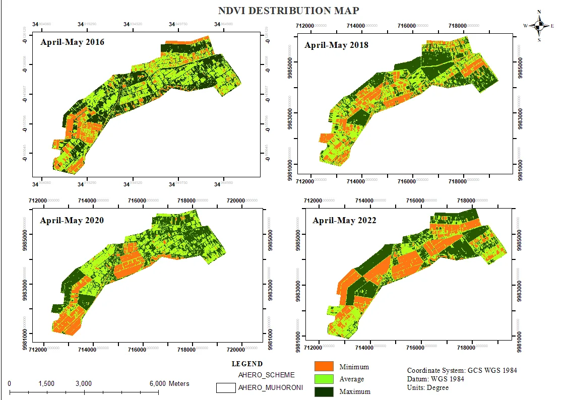
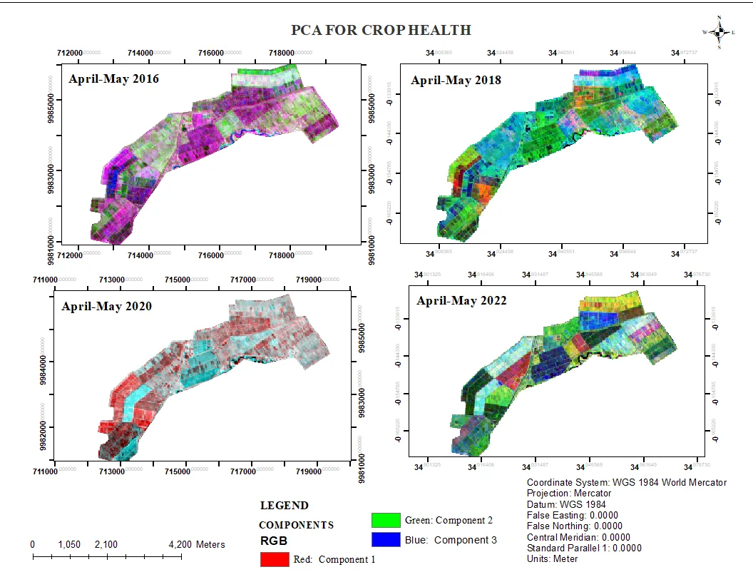
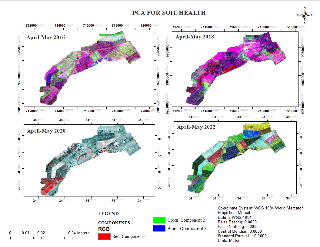
A spectral index stack (NDVI, NDMI, SAVI, SOCI) combined with principal component analysis to map crop and soil health variability across the scheme.
- Role
- Remote Sensing Analyst
- Period
- 2024
- Location
- Ahero, Kisumu County
- Google Earth Engine
- ENVI
- QGIS
The problem
Different parts of a large irrigation scheme perform very differently. To guide fertiliser, water and management decisions, the scheme needed a spatial read on where crops and soils are thriving and where they are stressed.
Approach
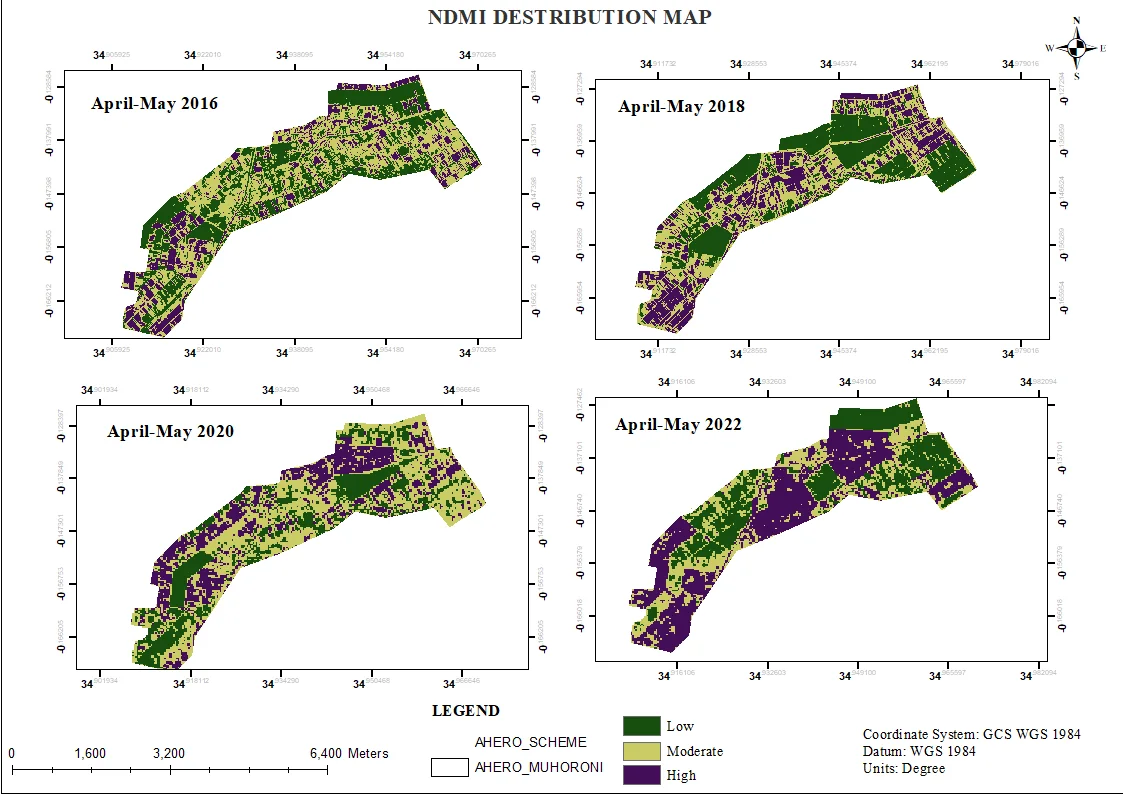
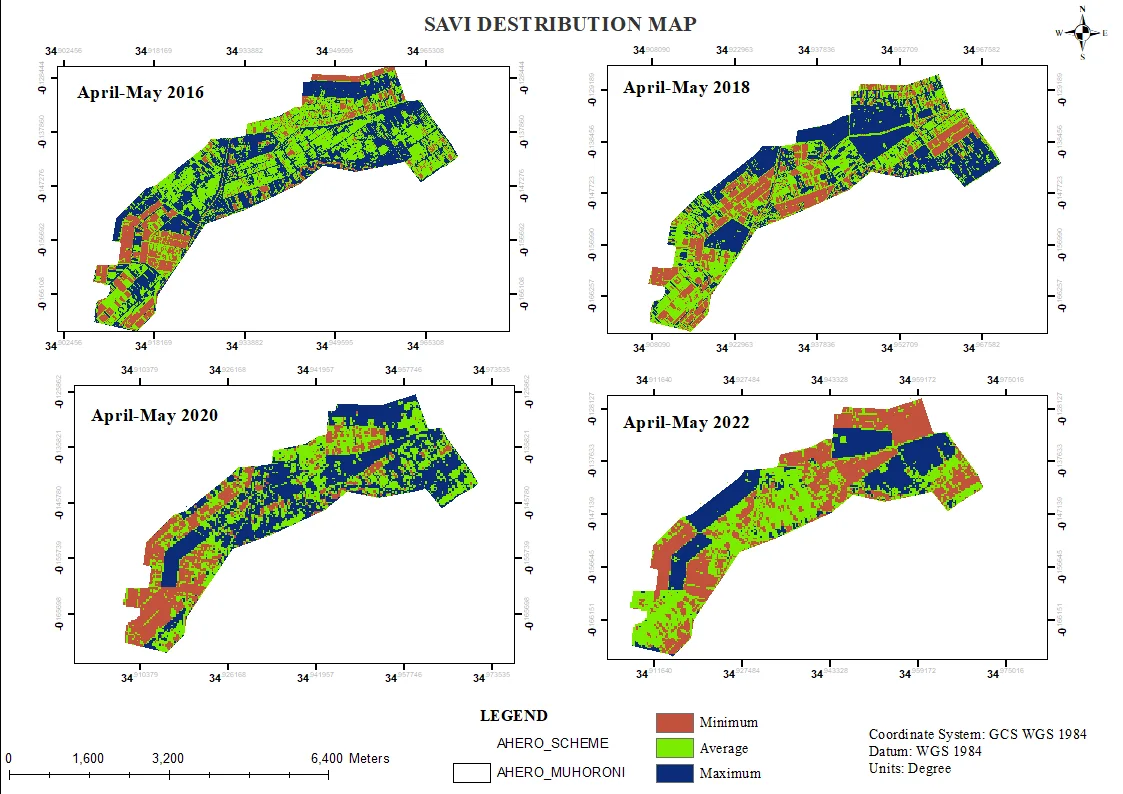
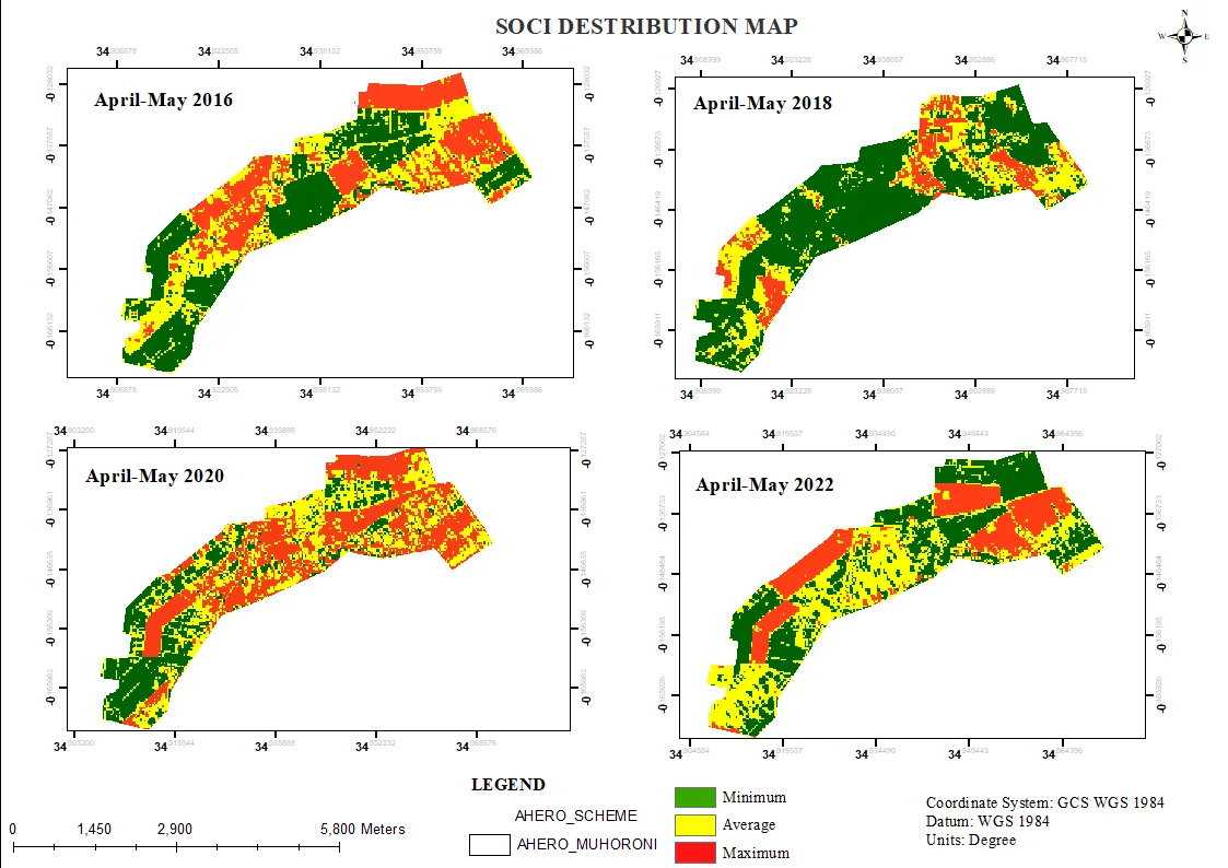
- Computed a core stack of spectral indices — NDVI, NDMI, SAVI and SOCI — to capture vegetation vigour, moisture and soil organic signals.
- Applied principal component analysis (PCA) separately for crop health and soil health to reduce the many correlated bands into interpretable components.
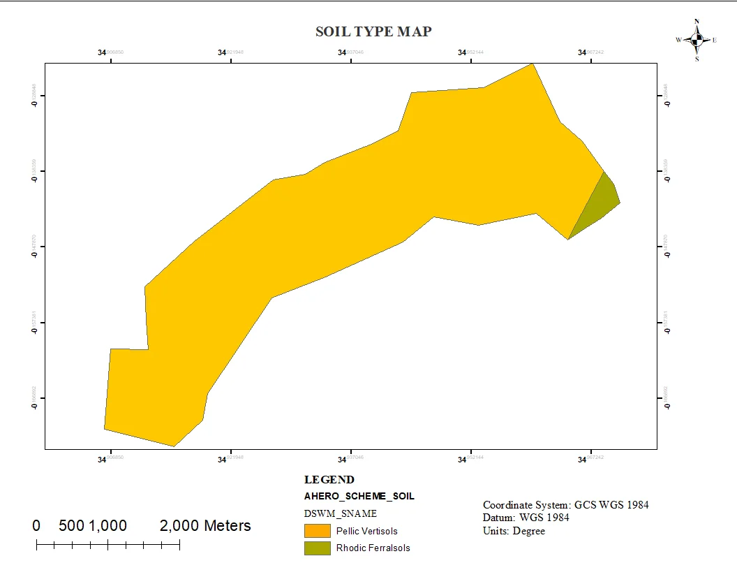
- Laid the results out as a consistent, comparable series of maps with matching legends and symbology.
Result
A visual diagnostic of variability across the scheme — a foundation for targeted interventions and a repeatable template for seasonal monitoring.
Gallery
More in Remote Sensing
Remote Sensing
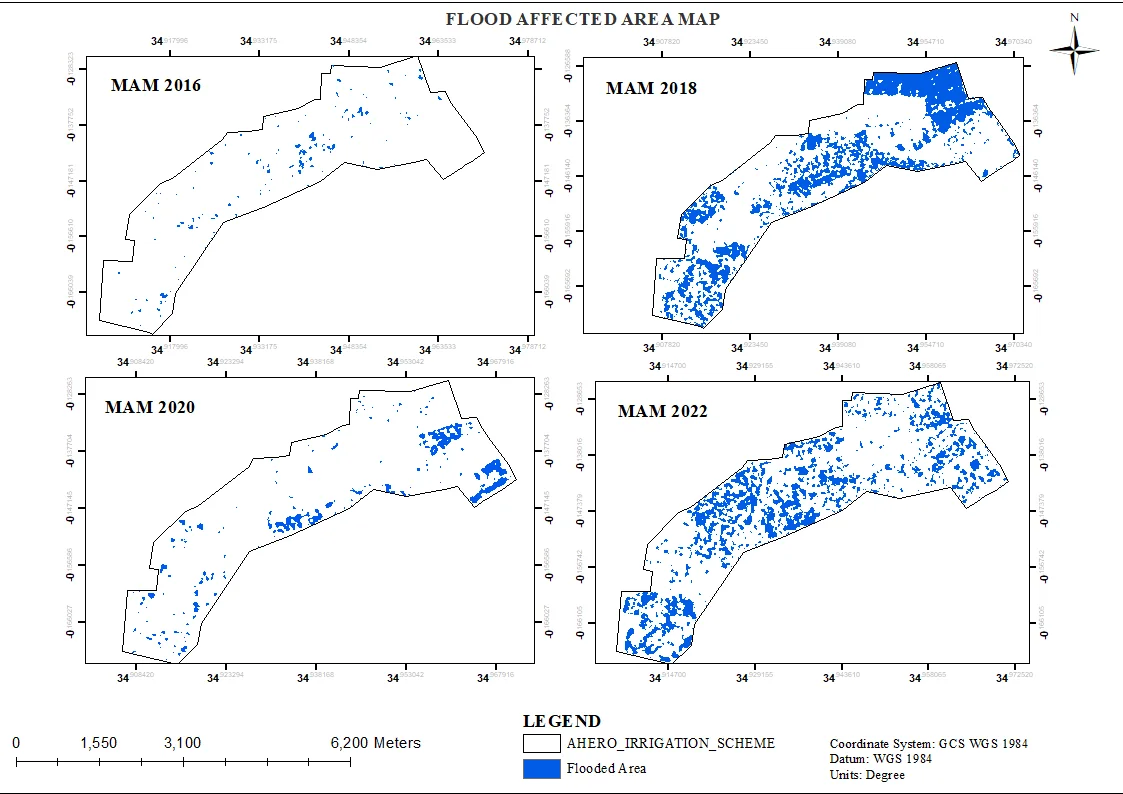
Ahero Irrigation Scheme — Flood Extent Monitoring
Multi-year flood extent mapping (2016–2022) for 2,500+ hectares of rice fields using satellite imagery and Google Earth Engine.
- Google Earth Engine
- QGIS
- ArcGIS Pro