Cartography
KFC Upper Compass — Facility Mapping
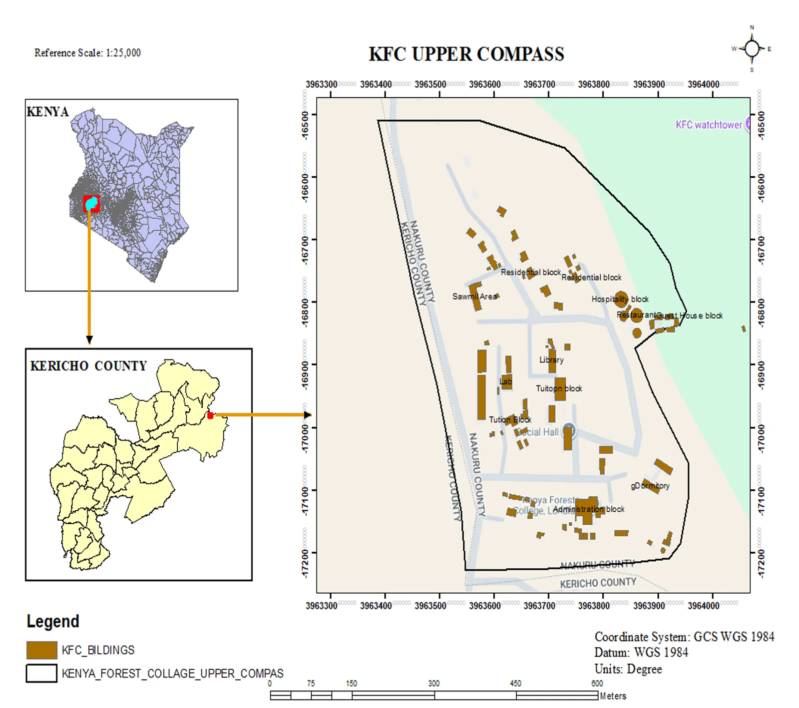
Topographic facility map of the Kenya Forest College upper campus in Kericho, produced at 1:25,000 with a Kenya and Kericho County locator inset.
- ArcGIS Pro
- QGIS
Geoinformation Science · Earth Observation
I turn spatial data into decisions — mapping, remote sensing and survey work for agriculture, environment and infrastructure projects.

Cartography
Standards-compliant maps, locator insets and presentation-ready layouts.
Remote Sensing
Earth observation, spectral indices and time-series analysis for land and water.
Surveying
Setting-out, level control, plan layouts and longitudinal profiles.
Field Data
GPS/GNSS field capture, site documentation and construction support.
About
Geoinformation Science & Earth Observation Specialist
I am a detail-oriented GIS professional with hands-on experience in geospatial data analysis, remote sensing and spatial database management across agricultural, environmental and government sectors.
My work spans satellite image processing, GPS field data collection and a multi-platform geospatial toolset — ArcGIS Pro, QGIS, AutoCAD Civil 3D and Google Earth Engine — with a focus on compliance-driven mapping, infrastructure digitisation and spatial modelling.
I have contributed to large-scale environmental monitoring and disaster risk reduction initiatives, improving operational planning and resource allocation through data-driven insights, and I am committed to accuracy, sustainability and adaptive problem solving in both field and institutional settings.
Career
Kenya Forest Service (KFS) · Kericho, Kenya
Redfin Engineering Ltd · Nairobi, Kenya
Ruaraka Survey Office · Nairobi, Kenya
Portfolio
Topographic facility map of the Kenya Forest College upper campus in Kericho, produced at 1:25,000 with a Kenya and Kericho County locator inset.
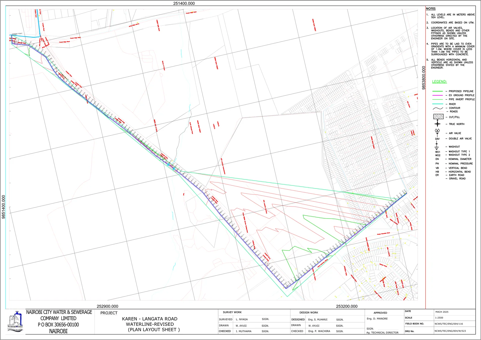
Setting-out, plan layout and longitudinal profile sheets for a 3.4 km water pipeline extension for Nairobi City Water & Sewerage Company.
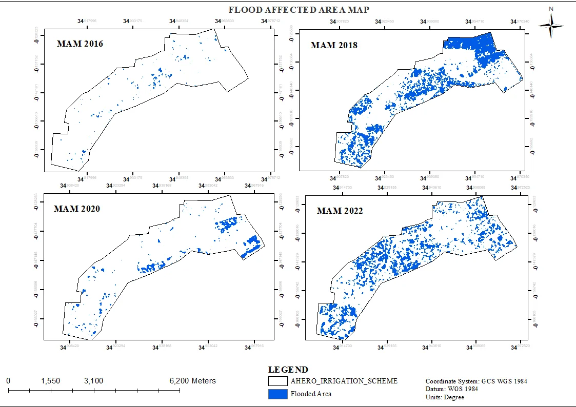
Multi-year flood extent mapping (2016–2022) for 2,500+ hectares of rice fields using satellite imagery and Google Earth Engine.
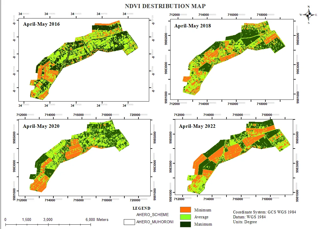
A spectral index stack (NDVI, NDMI, SAVI, SOCI) combined with principal component analysis to map crop and soil health variability across the scheme.
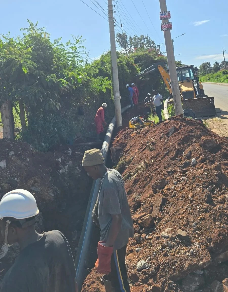
Field setting-out, level control and site documentation for urban water pipeline installation, including Bill of Quantities support.
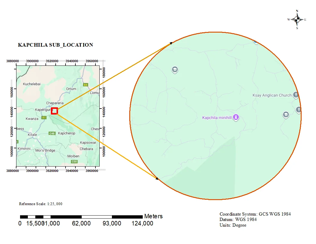
Administrative sub-location map with clean boundary delineation and locator context for planning and reporting.
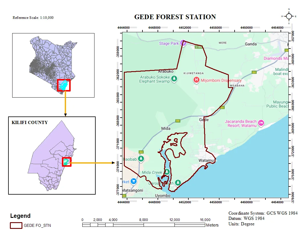
Thematic map production for the Gede area, combining field data with base layers for presentation-ready output.
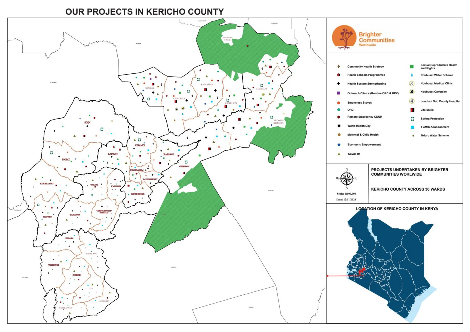
County-scale overview map locating BCW projects across Kericho County for coordination and communication.
No projects in this category yet.
Capabilities
Recognition
Certification
Dedan Kimathi University of Technology
Certification
Digital World Tech Academy
Leadership
Dedan Kimathi University of Technology · Apr 2022 – May 2024
Achievement
Redfin Engineering Ltd
Achievement
Google Earth Engine project
Achievement
Kenya Forest Service
Contact
Open to GIS, remote sensing and survey roles, consulting and collaborations.
samwelochieng024@gmail.com
Phone
+254 75 866 7410
Location
Nairobi & Kericho, Kenya
in/samwel-ochieng
Fill this in and it goes straight to my inbox — you'll get a confirmation too.