
KFC Upper Compass — Facility Mapping
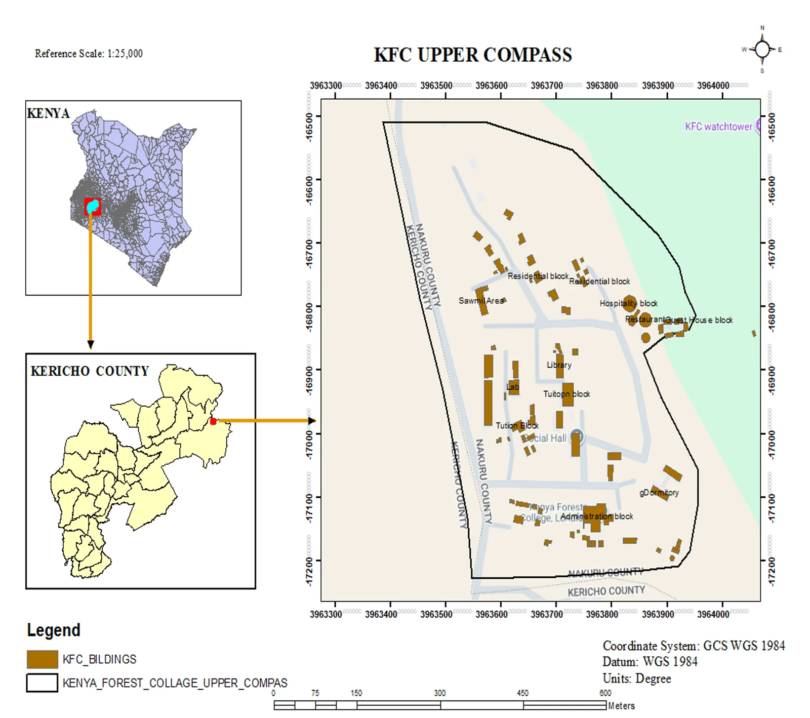
Topographic facility map of the Kenya Forest College upper campus in Kericho, produced at 1:25,000 with a Kenya and Kericho County locator inset.
- Role
- Cartographer / GIS Analyst
- Period
- 2025
- Location
- Kericho, Kenya
- ArcGIS Pro
- QGIS
The brief
Produce a presentation-ready facility map of the Kenya Forest College upper campus that places every building and block in its correct spatial context, while making the campus easy to locate for anyone opening the drawing cold.
What I did
- Delivered the main map frame at 1:25,000 with a full building and road network, labelled by function (administration, library, hostels, lecture halls, dining, hospital, sawmill area, watchtower).
- Built a two-step locator inset — Kenya on top, Kericho County below — joined to the study area with connector arrows so the location reads instantly.
- Applied a consistent cartographic layout: north arrow, scale bar, legend, projection and datum notes (GCS WGS 1984).
- Styled building footprints with a distinct fill to separate them from background reference layers.
Result
A single, standards-compliant sheet that works both as an operational reference for station staff and as a communication asset for visitors and partners.
The interactive map below is an early preview. Drop in the original shapefile/GeoJSON to make it fully authoritative.
Interactive map
Facility positions shown are illustrative placeholders. They will be replaced with the original survey geodata in a future update.
More in Cartography
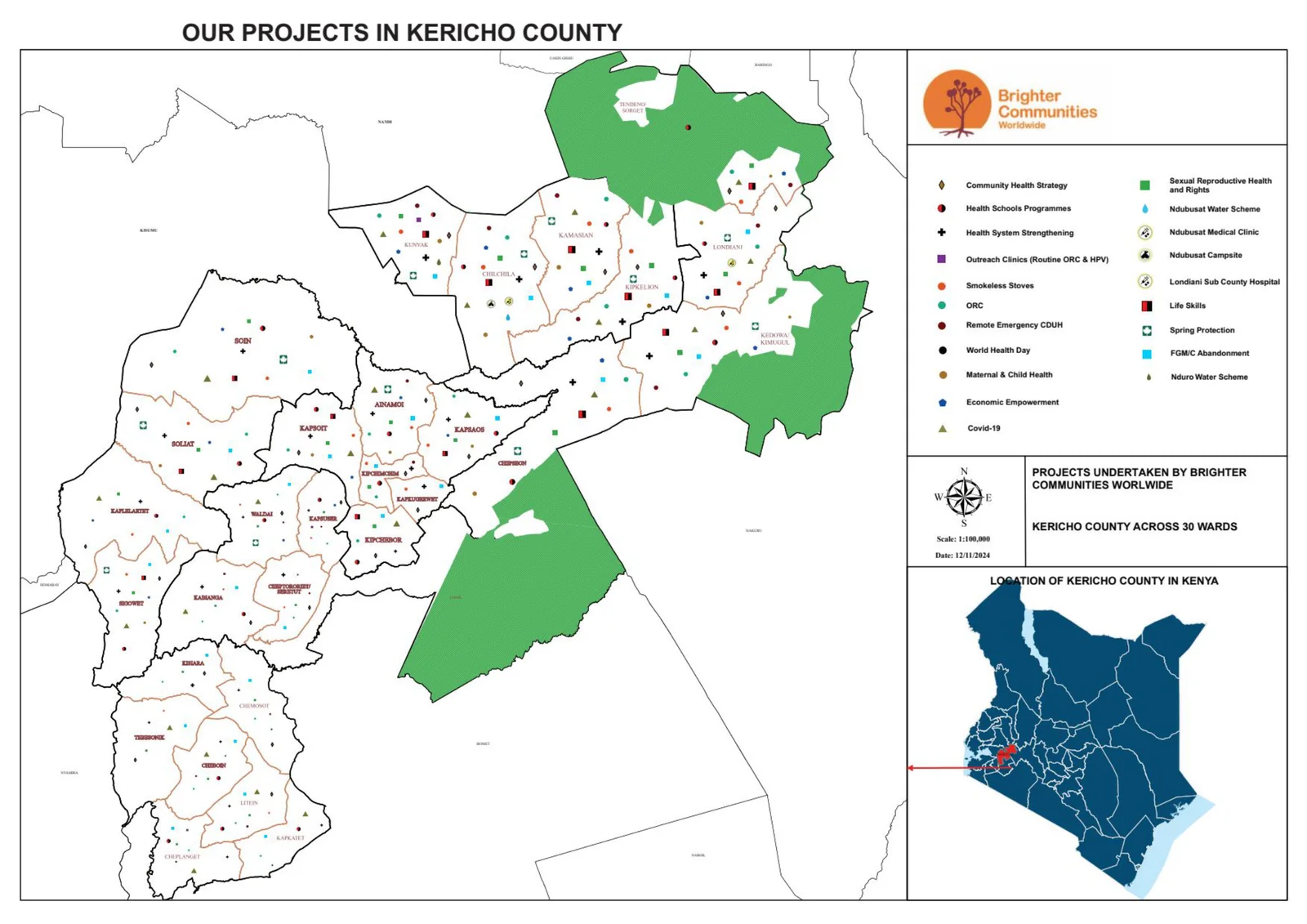
BCW Projects in Kericho County
County-scale overview map locating BCW projects across Kericho County for coordination and communication.
- ArcGIS Pro
- QGIS
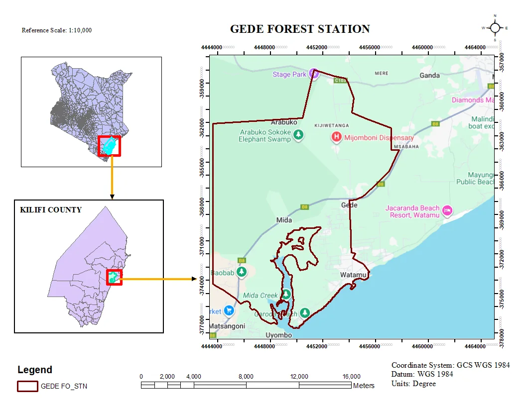
Gede Area Mapping
Thematic map production for the Gede area, combining field data with base layers for presentation-ready output.
- ArcGIS Pro
- QGIS
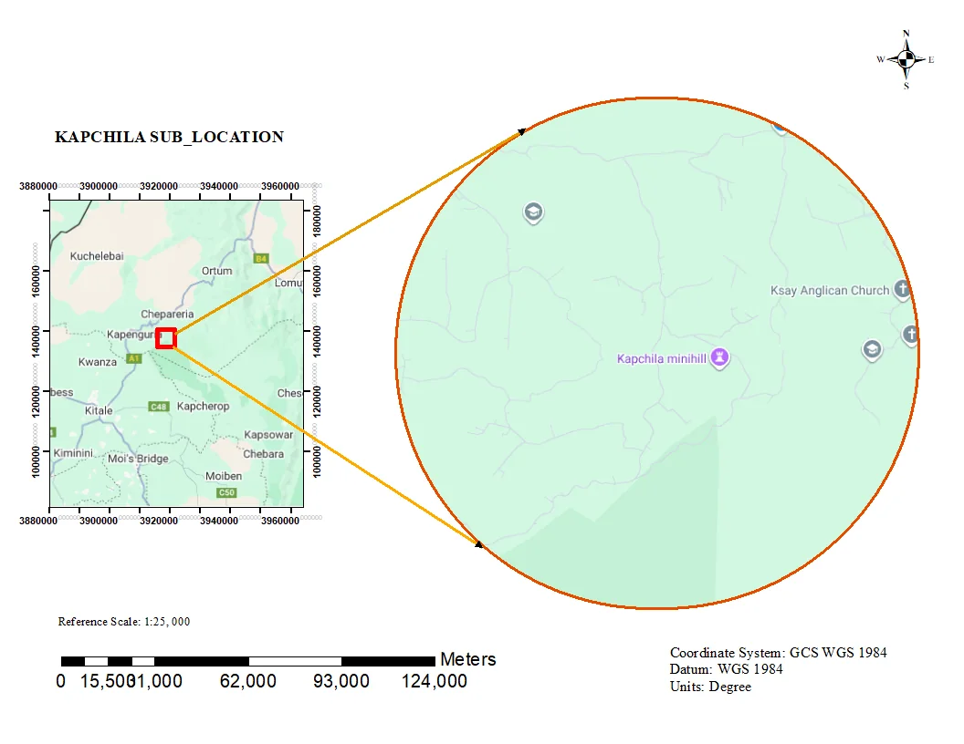
Kapchila Sub-Location Boundary Map
Administrative sub-location map with clean boundary delineation and locator context for planning and reporting.
- ArcGIS Pro
- QGIS