Cartography
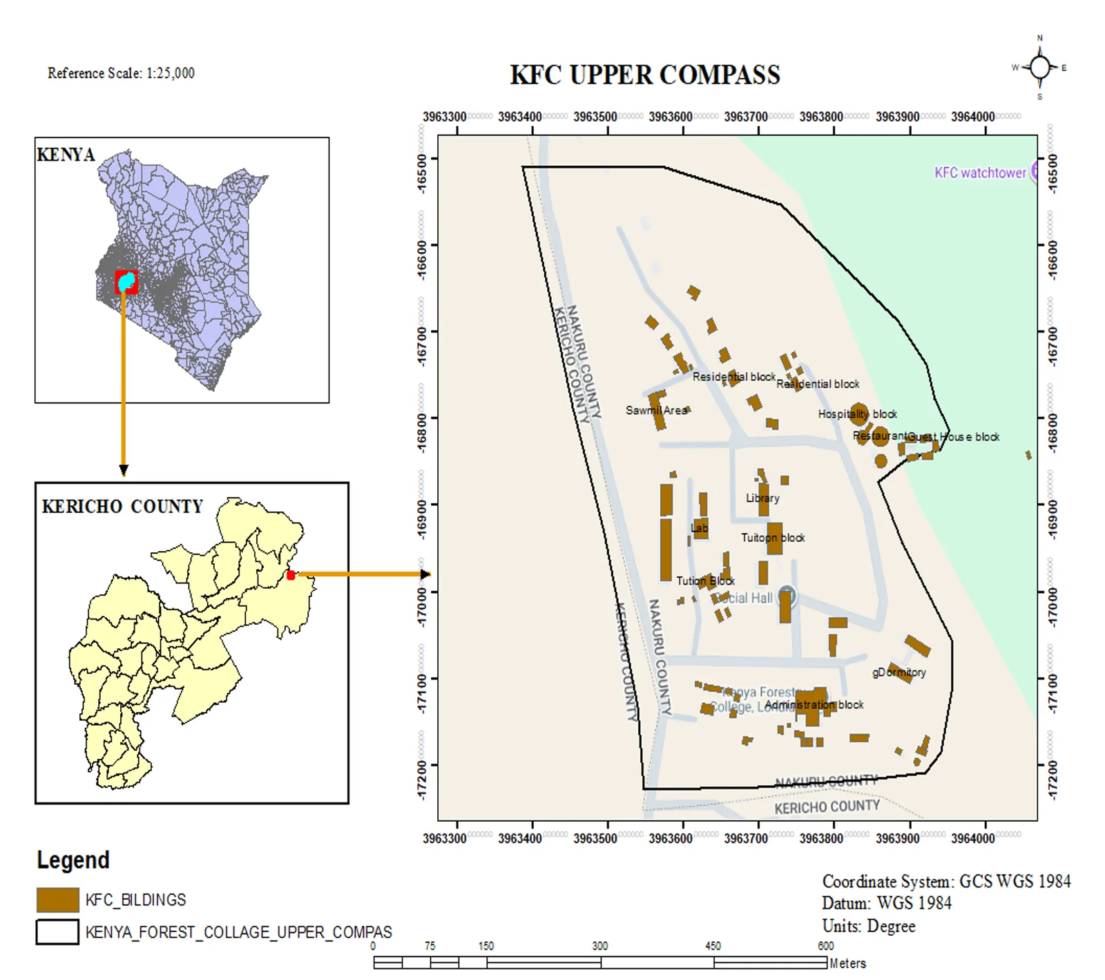
KFC Upper Compass — Facility Mapping
Topographic facility map of the Kenya Forest College upper campus in Kericho, produced at 1:25,000 with a Kenya and Kericho County locator inset.
- ArcGIS Pro
- QGIS
Portfolio
A cross-section of work across cartography, Earth observation, surveying and field data collection — from county-scale maps to 3.4 km pipeline setting-out.
Topographic facility map of the Kenya Forest College upper campus in Kericho, produced at 1:25,000 with a Kenya and Kericho County locator inset.
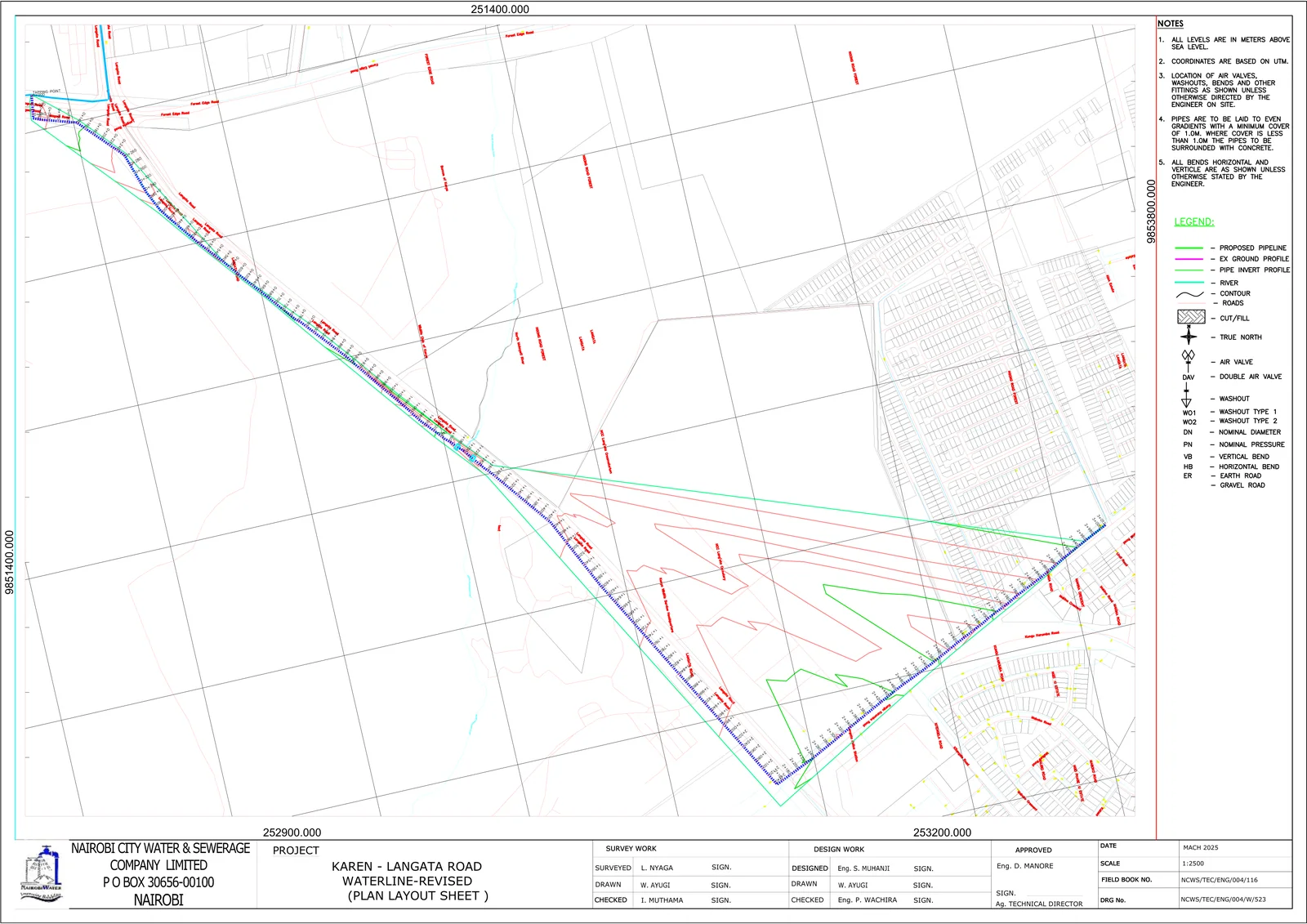
Setting-out, plan layout and longitudinal profile sheets for a 3.4 km water pipeline extension for Nairobi City Water & Sewerage Company.
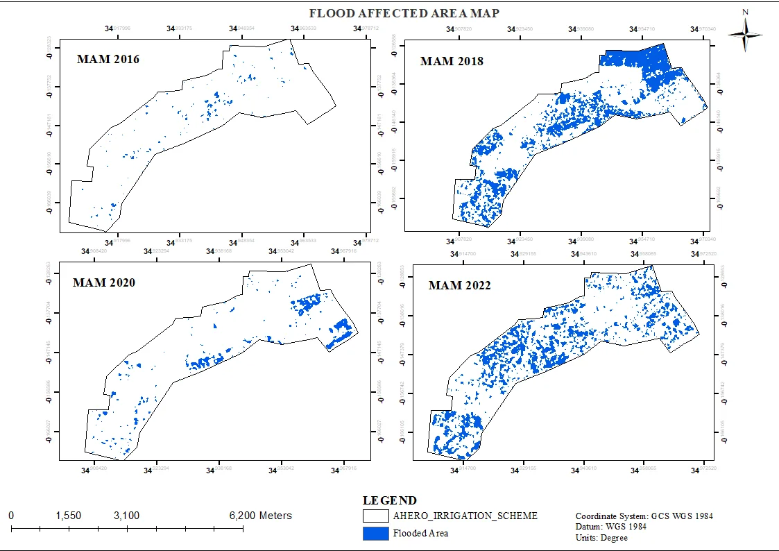
Multi-year flood extent mapping (2016–2022) for 2,500+ hectares of rice fields using satellite imagery and Google Earth Engine.
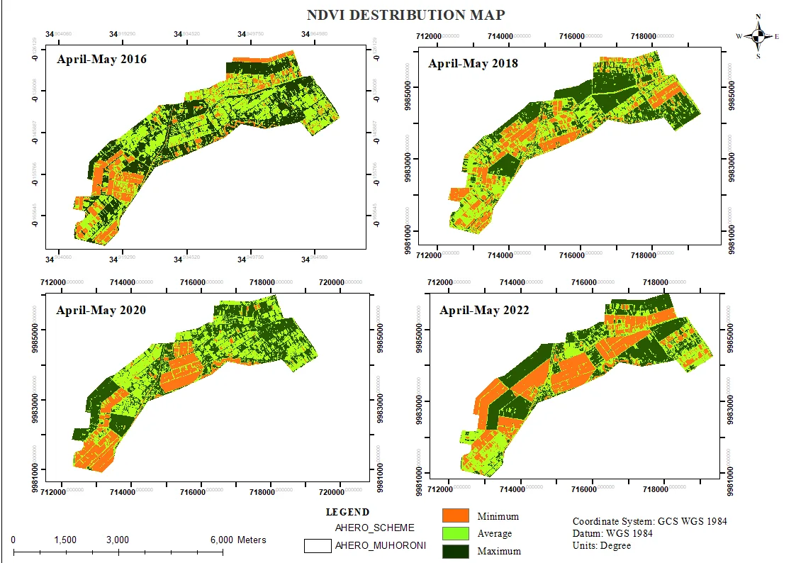
A spectral index stack (NDVI, NDMI, SAVI, SOCI) combined with principal component analysis to map crop and soil health variability across the scheme.
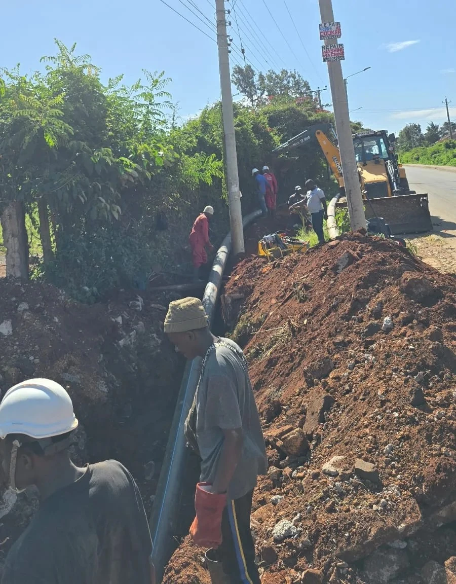
Field setting-out, level control and site documentation for urban water pipeline installation, including Bill of Quantities support.
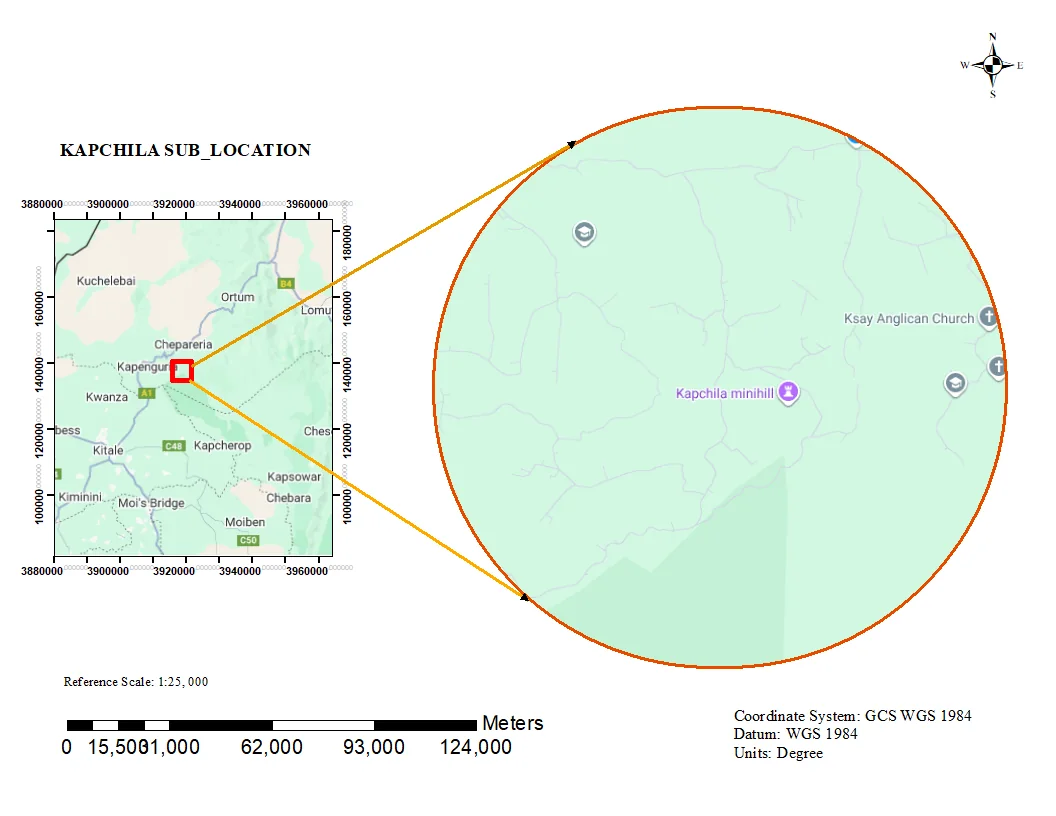
Administrative sub-location map with clean boundary delineation and locator context for planning and reporting.
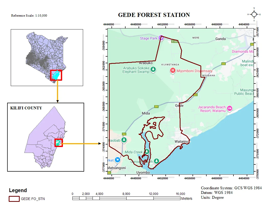
Thematic map production for the Gede area, combining field data with base layers for presentation-ready output.
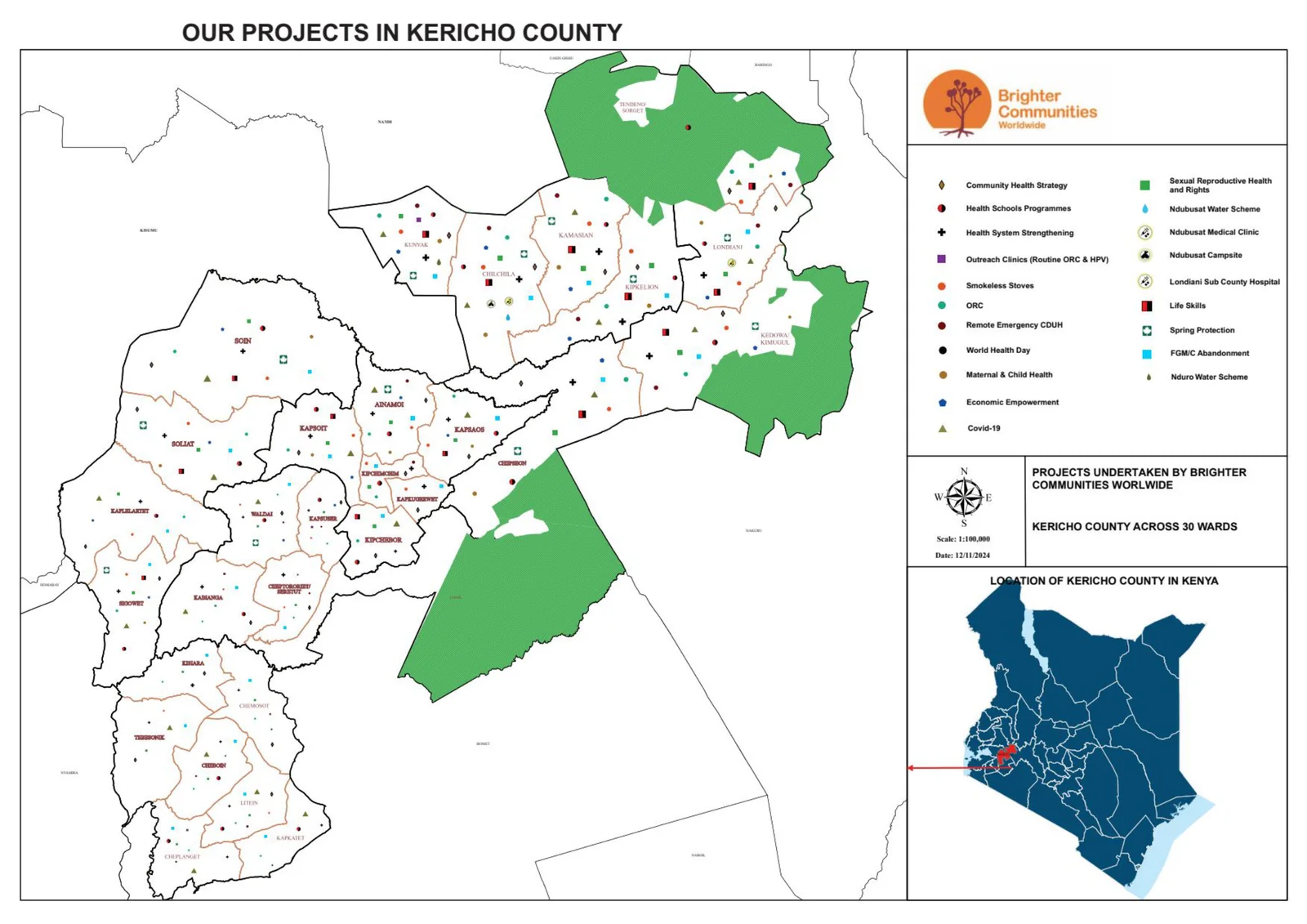
County-scale overview map locating BCW projects across Kericho County for coordination and communication.
No projects in this category yet.