
← All projects
Cartography & Map Production
Gede Area Mapping
Thematic map production for the Gede area, combining field data with base layers for presentation-ready output.
- Role
- Cartographer
- Period
- 2024
- Location
- Kilifi County, Kenya
- ArcGIS Pro
- QGIS
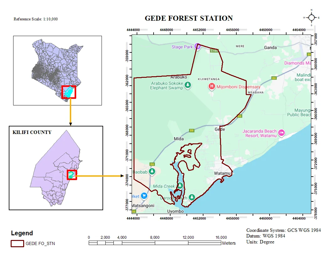
The output
A thematic map of the Gede area built from field-verified data layered over standard base mapping.
What I did
- Assembled and cleaned the input datasets, resolving geometry and attribute inconsistencies before symbolising.
- Designed a legible thematic layout with a consistent legend and print-ready framing for presentations and reports.
More in Cartography
Cartography
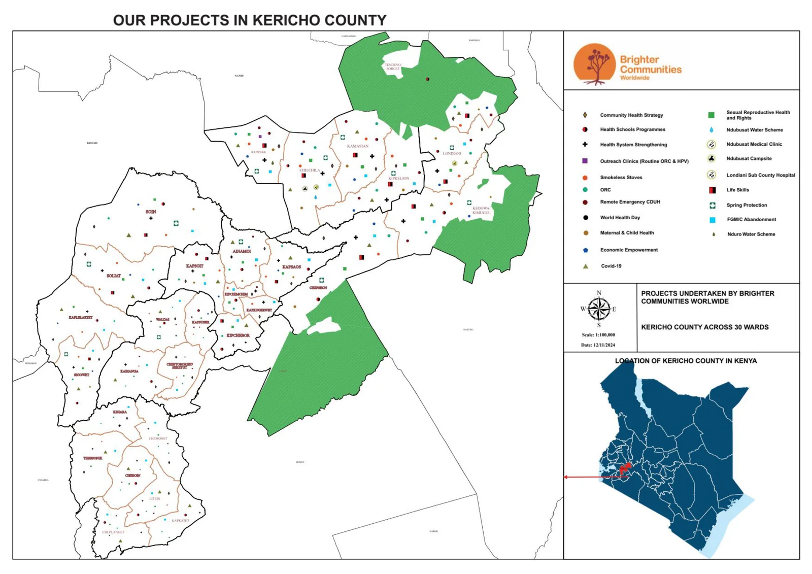
BCW Projects in Kericho County
County-scale overview map locating BCW projects across Kericho County for coordination and communication.
- ArcGIS Pro
- QGIS
Cartography
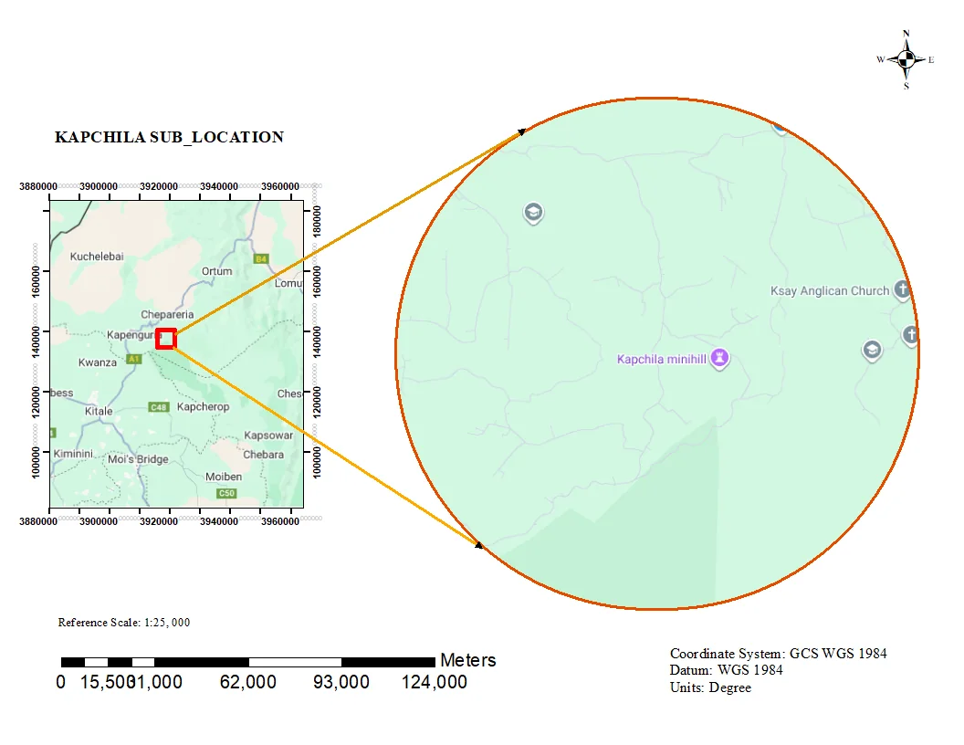
Kapchila Sub-Location Boundary Map
Administrative sub-location map with clean boundary delineation and locator context for planning and reporting.
- ArcGIS Pro
- QGIS
Cartography
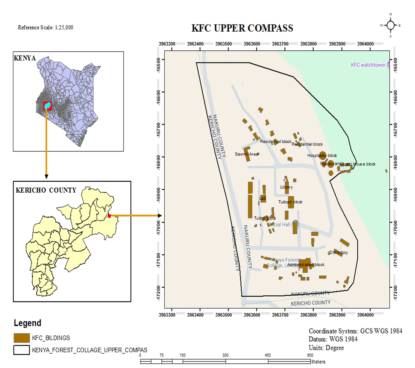
KFC Upper Compass — Facility Mapping
Topographic facility map of the Kenya Forest College upper campus in Kericho, produced at 1:25,000 with a Kenya and Kericho County locator inset.
- ArcGIS Pro
- QGIS