
← All projects
Remote Sensing & Environmental Analysis
Ahero Irrigation Scheme — Flood Extent Monitoring
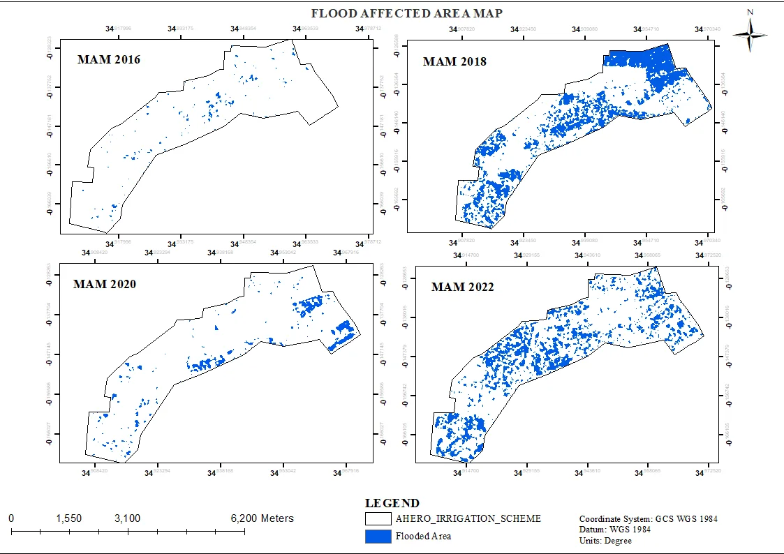
Multi-year flood extent mapping (2016–2022) for 2,500+ hectares of rice fields using satellite imagery and Google Earth Engine.
- Role
- Remote Sensing Analyst
- Period
- 2024
- Location
- Ahero, Kisumu County
- Google Earth Engine
- QGIS
- ArcGIS Pro
The problem
Recurring floods across the Ahero irrigation scheme damage rice crops and disrupt productivity. The scheme needed a clear, evidence-based picture of where and when flooding occurs so that hazard planning and resource allocation could be targeted.
Approach
- Built a Google Earth Engine workflow to classify flood extent across multiple seasons, comparing rainfall-driven events from 2016 to 2022.
- Extracted and cleaned flood masks, then exported them for cartographic layout in QGIS/ArcGIS Pro.
- Produced a comparable multi-panel product so changes between years can be read at a glance.
Result
Flood risk mapping for 2,500+ hectares of rice fields, supporting proactive hazard planning and helping protect yield through better-timed interventions.
Gallery
More in Remote Sensing
Remote Sensing
Ahero Irrigation Scheme — Crop & Soil Health Analysis
A spectral index stack (NDVI, NDMI, SAVI, SOCI) combined with principal component analysis to map crop and soil health variability across the scheme.
- Google Earth Engine
- ENVI
- QGIS